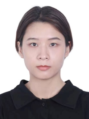
个人简介
李媛,中山大学遥感科学与技术学院副教授
教育经历
2009.09 - 2013.07,武汉大学,遥感信息工程学院,工学学士
2013.09 – 2016.07,武汉大学,测绘遥感信息工程国家重点实验室,工学硕士
2016.08 – 2020.07,香港理工大学,测绘与地理资讯学系,哲学博士
工作经历
2025.04 – 至今,中山大学,副教授
2020.09 – 2025.03,中山大学,助理教授
科研项目
1. 广东省自然科学基金面上项目,纵向,2024A1515012079,基于几何与纹理融合建模的建筑物精细标签单体化重建, 2024-01-01至2026-12-31,15万元,在研,主持
2. 国家自然科学基金青年项目,纵向,42201476, 面向自动LOD3精细语义建模的多样化建筑物构件提取与重建, 2023-01至2025-12, 30万元,在研,主持
3. 光电测量与智能感知中关村开放实验室开放基金,纵向,LabSOMP-2024-09,基于面阵单光子激光雷达的月球车绝对定位与建图,2024.08-2026.07,16万元,在研,主持
4. 遥感科学国家重点实验室, 横向, OFSLRSS202108, 火星表面石块三维形态与丰度特征研究, 2021-08至 2023-07, 8万元, 结题, 主持
5. 探月与航天工程中心技术服务,横向,1040012022000024,国际月球科研站综合选址方法研究,2022-06至2022-11, 20万元,结题,主持
学术论文
期刊论文:
Zhi, Z., Chang, B., Li, Y.*, Du, Z., Zhao, Y., Cui, X., Ran, J., Li, A.*, Zhang, W. (2025). P-CSF: Polar coordinate cloth simulation filtering algorithm for multi-type tunnel point clouds. Tunnelling and Underground Space Technology, 155, 106144.
Chang, B., Xiong, H., Li, Y.*, Pan, D., Cui, X., & Zhang, W. (2024). ALCSF: An adaptive and anti-noise filtering method for extracting ground and top of canopy from ICESat-2 LiDAR data along single tracks. ISPRS Journal of Photogrammetry and Remote Sensing, 215, 80-98.
Ma, C., Li, Y.*, Lv, J., Xiao, Z., Zhang, W., Mo, L. (2024). Automated rock detection from Mars rover image via Y-Shap dual-task network with depth-aware spatial attention mechanism. IEEE Transaction on Geoscience and Remote Sensing, vol. 62, pp. 1-18.
Li, Y., Xiao, Z., Ma, C., Zeng, L., Zhang, W.*, Peng, M., & Li, A. (2023). Extraction and Analysis of Three‐Dimensional Morphological Features of Centimeter‐Scale Rocks in Zhurong Landing Region. Journal of Geophysical Research: Planets, 128(7), e2022JE007656.
Li, Z., Wu, B.*, Li, Y., & Chen, Z. (2023). Fusion of aerial, MMS and backpack images and point clouds for optimized 3D mapping in urban areas. ISPRS Journal of Photogrammetry and Remote Sensing, 202, 463-478.
Xiao Z., Yan P., Ding C., Li Y., Chang Y., Xu R., Wu Y., Wang Y., et al., 2022. Translucent glass globules on the Moon. Science Bulletin. 67(4), 355-358.
Xiao Z., Zeng L., Li Y.*, Shao J., Ma C., Zhang W.*, & Peng M., 2022. High-Precision Measurement of 3D Rock Morphology on Mars Using Stereo Rover Imagery. IEEE Geoscience and Remote Sensing Letters. doi: 10.1109/LGRS.2022.3154629.
Guo D., Fa W.*, Wu B., Li Y., & Liu Y., 2021. Millimeter‐to Decimeter‐Scale Surface Roughness of the Moon at the Chang'e‐4 Exploration Region. Geophysical Research Letters, 48(19), e2021GL094931.
Chen L., Wu B.*, Zhao Y., & Li Y., 2021. A Real-Time Photogrammetric System for Acquisition and Monitoring of Three-Dimensional Human Body Kinematics. Photogrammetric Engineering & Remote Sensing, 87(5), 363-373.
Li Y., Wu B.*, 2021. Relation-constrained 3D reconstruction of buildings in metropolitan areas from photogrammetric point clouds. Remote Sensing 13(1), 129.
Wu B.*, Li Y., Liu W.C., Wang Y., Li F., Zhao Y., Zhang H., 2021. Centimeter-resolution topographic modelling and fine-scale analysis of craters and rocks at the Chang’E-4 landing site. Earth and Planetary Letters 553, 116666.
Ding C., Xiao Z.*, Wu B., Li Y., Prieur NC., Cai Y., Su Y., Cui J., 2020. Fragments delivered by secondary craters at the Chang’E-4 landing site. Geophysical Research Letters 47(7), e2020GL087261.
Li Y., Wu B.*, Ge X., 2019. Structural segmentation and classification of mobile laser scanning point clouds with large variations in point density. ISPRS Journal of Photogrammetry and Remote Sensing 153, 151-165.
Ge X., Wu B*., Li Y., Hu H., 2019. A multi-primitive-based hierarchical optimal approach for semantic labeling of ALS point clouds. Remote Sensing 11(10), 1243.
Wu B.*, Huang J., Li Y., Wang Y., Peng J., 2018. Rock abundance and crater density in the candidate Chang’E-5 landing region on the Moon. Journal of Geophysical Research: Planets 123(12), 3256 – 3272.
Li Y., Wu B.*, 2018. Analysis of rock abundance on lunar surface from orbital and descent images using automatic rock detection. Journal of Geophysical Research: Planets 123(5), 1061 – 1088.
Zhu Q., Li Y., Hu H.*, Wu B., 2017. Robust point cloud classification based on multi-level semantic relationships for urban scenes. ISPRS Journal of Photogrammetry and Remote Sensing 129, 86 – 102.
李媛,胡翰*,谢金华,朱庆,张叶廷,杜志强,彭明军,高山,2016. 局部区域表面一致性约束的三维模型纹理映射方法. 武汉大学信息科学版 41(12), 1599 – 1604.
会议论文:
Li, Y.*, 2023. 3D geo-referencing of free model through 3D-to-2D alignments at the CE-5 landing site. The International Archives of the Photogrammetry, Remote Sensing and Spatial Information Science, 48, 1051-1058.
Li Y, Wu B., 2020. Automatic 3D reconstruction of complex buildings from incomplete point clouds with topological-relation constraints. ISPRS Annals of the Photogrammetry, Remote Sensing and Spatial Information Sciences V5:85-92.
Li Z., Wu B., Li Y, 2020. Integration of aerial, MMS and backpack images for seamless 3D mapping in urban areas. The International Archives of Photogrammetry, Remote Sensing and Spatial Information Sciences 43, 443-449.
Li Y., Wu B., 2019. Structural segmentation of point clouds with varying density based on multi-size supervoxels. ISPRS Annals of the Photogrammetry, Remote Sensing and Spatial Information Sciences. IV-2/W5, 389 – 396.
学生培养
1. 2024 Symposium TC III Best Young Authors Award, Category 1 Technologies First Prize, 指导老师:李媛、张吴明,学生:张旭盛
2. 2024年第八届激光雷达大会“华测杯”三维数字底座基础地理数据处理竞赛特等奖,指导老师:李媛,学生:孙倩,张振羽,谢奕伽,熊子一,陈杨
3. 2020年第六届激光雷达学术会议激光扫描数据处理大赛团队二等奖,指导老师:李媛,学生:肖宙轩、曾林洲、马潮华、吕嘉欣、周钟炎
4. 2023第十八届中国地理信息科学理论与方法学术年会论文竞赛二等奖,指导老师:李媛,学生:黎锦鹏
5. 2023年第九届全国虚拟地理环境会议“优秀青年论文”,指导老师:李媛,学生:张天柱
6. 2023年校级大学生创新创业训练计划项目《基于虚拟仿真的火星车LIDAR自主导航研究》(优秀结题),指导老师:李媛,学生:兰钧、杨邦烁、傅雨晴、万长城

