
News | Observing the sky and measuring the sea, dreaming of the deep blue - the School of Surveying and Mapping participated in the first scientific research equipment acceptance voyage of "Sun Yat-Sen University
Ocean power strategy is one of the major national strategies. Since the 18th CPC National Congress, the CPC Central Committee, with Comrade Xi Jinping as the core, has attached great importance to the development of the marine industry and integrated the building of a strong marine state into the "two hundred years" goal. Comrade Xi Jinping pointed out in the report of the 19th Party Congress: "Adhere to the integration of land and sea, and accelerate the construction of a strong ocean country." China is a large developing country with both land and sea, and building a strong ocean country is an important part of building a strong socialist modern country in all aspects.
Marine mapping is the implementation of the national marine development strategy of the prospective, basic and public welfare undertakings, is the ocean development and management, rights and interests of maintenance, disaster prevention and mitigation and scientific research and other precursors and foundations. Carry out marine basic mapping, a comprehensive and accurate grasp of marine basic geographic information, is an important guarantee and a solid foundation for the realization of a strong marine state.
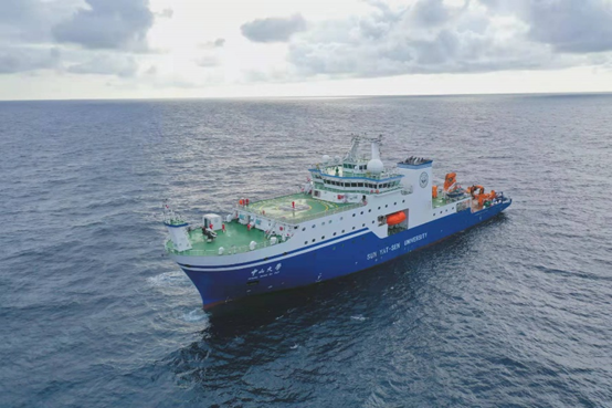
On June 26, 2021, the "Zhong Shan Da Xue" marine comprehensive scientific research practice ship was officially delivered. "Zhongshan University" is currently the largest design displacement, comprehensive scientific research performance of the strongest comprehensive marine scientific research internship, displacement of 6,880 tons, endurance 15,000 nautical miles, with global navigation capabilities. On November 21 of the same year, "Zhong Shan Da Xue" was berthed at Beacon Marine Terminal in Gaolan Port, Zhuhai, and officially put into use.
Pre-aviation preparation
In order to ensure the smooth acceptance of the marine surveying and mapping equipment of the research vessel "Sun Yat-Sen University", a group of eight teachers and students from the School of Surveying and Mapping went to Zhuhai Gaolan Port on December 15, 2021 to prepare for the voyage. The calibration team consisted of three assistant professors, Li Gang, Chen Pengfei and Yang Meng, who were responsible for the observation and analysis of the high-precision datum, and the calibration of the relative offset between multiple sensor platforms through the total station precision engineering measurement. The UAV testing team was led by Assistant Professor Shuhang Zhang to verify the smooth takeoff and landing techniques of UAV under the magnetic field and swaying conditions of the ship.
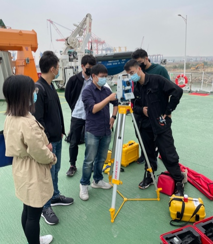
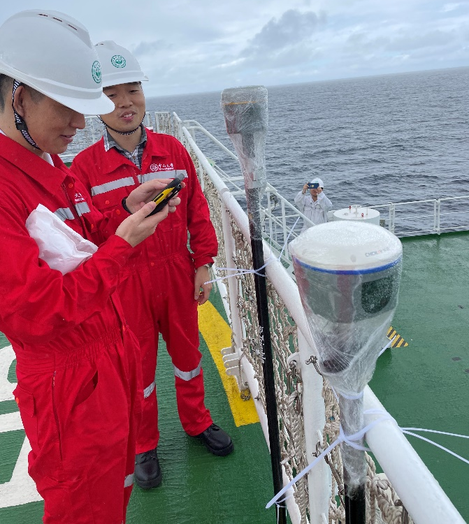
Deviation calibration of ocean gravimeter and DGPS instruments

UAV marine low altitude remote sensing platform testing
Test voyage
The Oceanographic Research Center of Sun Yat-Sen University organized the first scientific research equipment acceptance cruise from December 22 to 27, 2021. A group of seven members, including Professor Wei Feng, Assistant Professor Shuhang Zhang, Assistant Professor Xingyuan Yan, Engineer Jifeng Huang and Engineers Bin Wang, Xiaobin Liu and Dongfeng Huang from the Polar Research Center, participated in the scientific research mission of the voyage. A total of 95 members participated in the voyage, including crew members, teachers and students from sea-related faculties of Sun Yat-Sen University, including the School of Atmospheric Sciences, the School of Marine Science, the School of Earth Science and Engineering and the School of Geospatial Engineering and Science, and technical support teams from the Fifth Hospital of Sun Yat-Sen University, Jiangnan Shipyard, Xiamen International Trade, Beijing Laureate, Qingdao Shuide and Beijing Anda Xingchuang.
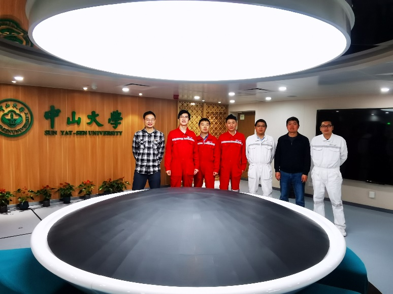
A group photo of the participants of the School of Surveying and Mapping and the Polar Research Center
As the core instrument of marine geophysical observation, the analysis of its data can obtain marine geological structure information and seafloor topography information. In addition, through the joint analysis of satellite gravity, ocean gravity, airborne gravity and ground gravity data, high-precision gravity field modeling and unification of sea and land elevation datum can be realized, which provides the basic guarantee for the integrated land-sea marine environment monitoring and marine economic development. During this trial voyage, Professor Wei Feng and others carried out gravity observation and comparison work on the high-precision ocean gravity instrument on board of the "Zhong Shan Da Xue".
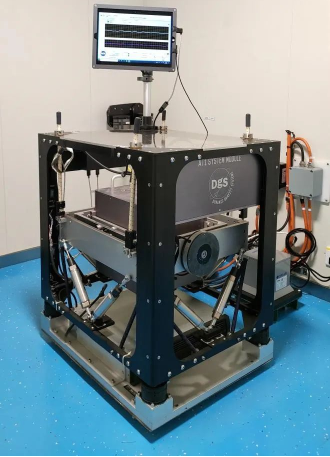
Gravimeter
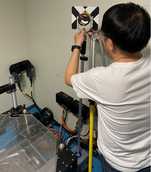
GNSS equipment provides absolute space-time reference for high-precision gravimeter, multibeam seafloor topographic mapping and research vessel navigation and positioning. "Zhong Shan Da Xue" is equipped with DGPS equipment, which provides navigation and positioning during navigation and operation, and its accuracy is better than 0.5 m. In order to obtain high-precision instrument platform position, high-precision GNSS equipment is needed to assist. In this scientific research voyage, Assistant Professor Xingyuan Yan and Engineer Jifeng Huang of the School of Surveying and Mapping used the Huazheng mobile measurement type receiver to collect BeiDou II/III, GPS, Galileo and GLONASS satellite observation data in some segments. Through post-event independent decomposition, they obtained precision orbits and precision clock difference products of navigation satellites, and used dynamic precision single-point positioning technology to decompose and obtain high-precision absolute position of the scientific research vessel route.
Carrying out dynamic and high-precision measurement operations with GNSS receivers
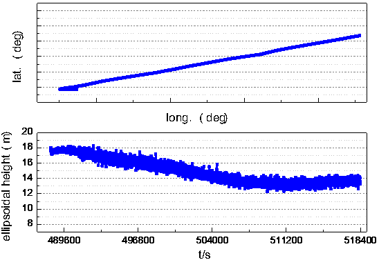
Plane coordinates and geodetic height for a certain 8 hours during the voyage
Assistant Professor Shuhang Zhang conducted a mobile takeoff and landing test on board the UAV and took a "working photo" of the "Zhong Shan Da Xue" based on the platform. The swaying of the ship and the sea wind posed a big challenge to the UAV shipboard takeoff and landing. For consumer-grade UAVs without precise positioning and tracking equipment, manually operated takeoff and landing is a better choice, and the visual guidance function of the UAV is turned off during the takeoff and landing process.
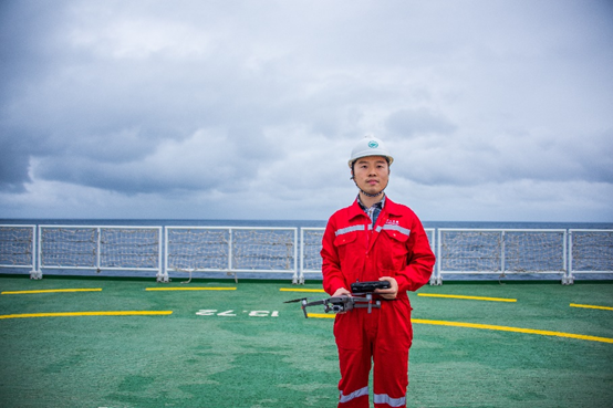
Assistant Professor Shuhang Zhang Conducts UAV Take-off and Landing Experiment
UAV photos of Zhong Shan Da Xue's offshore operations
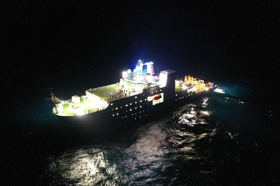
Night flight photos of the USS Zhong Shan Da Xue taken by drone
Party Building Topics
On the evening of December 24, 2021, the temporary party branch of the scientific research trial voyage of "Zhong Shan Da Xue" conducted an organizational life in the meeting room, which was presided over by Comrade Lan Liu from the School of Marine Science, secretary of the temporary party branch. The meeting revisited a series of important statements of General Secretary Jinping Xi on the development of marine economy. Participating members analyzed the current problems of China's marine scientific research from their respective professional perspectives and held a lively discussion on the planning of future scientific research missions and domestic and international cooperation. After the discussion and study, the party comrades deeply understood the importance of the ocean to China's economic and scientific development, and firmly established the mission and responsibility to serve the development strategy of the national ocean power.

Temporary Party Branch Marine Special Study and Discussion
Science Report
This trial voyage carried out three science lecture activities, a total of nine marine special science reports. A number of teachers from the College of Marine Science and Technology gave reports on the development of marine scientific research, scientific research experience and scientific research progress. Professor Wei Feng from the Institute of Oceanography gave a lecture on how to measure the weight of the earth, introduced the development of gravity measurement and its research progress in sea level change monitoring, seafloor topography inversion and water circulation with his own research experience.
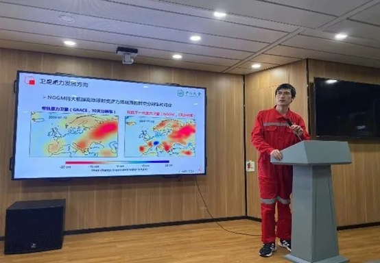
Gravity measurement science report
Conclusion
The new type of marine mapping based on the intelligent perception of air, sky and sea is one of the important development directions of the School of Surveying and Mapping. Facing the Guangdong-Hong Kong-Macau-Great Bay Area, relying on the research platform of "Zhong Shan Da Xue" and "Zhong Shan Da Xue Ji Di", the faculty and students set sail to start a new journey of "observing the sky and measuring the sea, dreaming of the deep blue". A new journey!
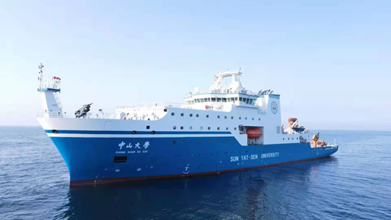
"Zhong Shan Da Xue" Marine Research Practice Vessel

Scientific research vessel "Zhong Shan Da Xue Ji Di"
