Satellite Precision Orbiting, Positioning and Navigation
1. Established the phase center correction model of BeiDou-2 and BeiDou-3 satellite antennas and the a priori optical pressure model of BeiDou-3 satellite to improve the accuracy of BeiDou orbiting and positioning; built a high-precision GNSS orbiting software system platform to realize multi-system precision orbiting, clock difference, troposphere, Earth rotation and frame coordinate solution; developed a fast processing algorithm based on matrix block disambiguation to realize GNSS multi-system "One-step" fast orbit setting and fast encryption of clock aberration. Based on the above software system platform, self-built optical pressure and antenna phase center model, the precision orbits of B1I/B3I satellites without ionosphere combination and the precision clock aberration of 30s interval are solved, and the accuracy of Beidou single system positioning is better than 5mm in horizontal direction and 1cm in elevation direction (IGS ascg station 2020 036 days results).
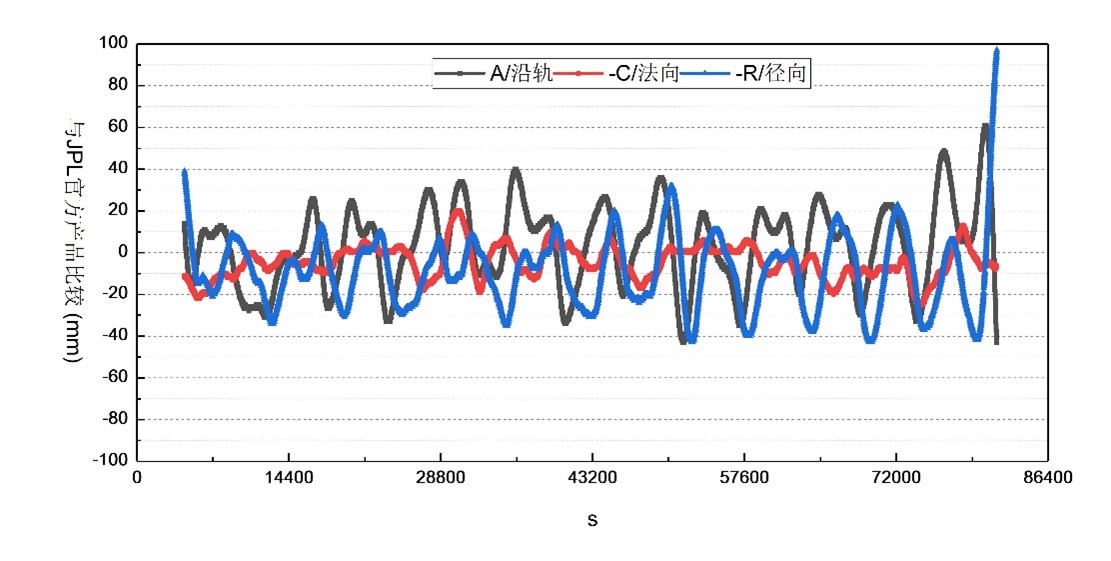
2. Based on the simplified kinetic orbiting method, the precision orbit and 30s clock difference of the CODE analysis center were used for precision orbiting of the GRACE-A satellite, and the orbiting accuracy was 19.8 mm for 24-hour RMS, 9.1 mm for normal RMS, and 19.9 mm for radial RMS in the along-orbit direction compared with the official precision orbit product published by JPL.
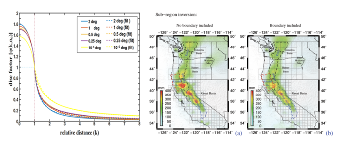
3. Expanding the new field of GNSS hydrology. Based on the load deformation theory and spatially constrained inversion model, high precision inversion of regional water storage variation is achieved by using GNSS vertical displacement. The method has been applied in the west coast region of the United States, and the estimation accuracy of regional boundary water storage with spatial constraints has been improved by 10~20%.