
Report on the Crisis in American Geodesy
Words written at the front
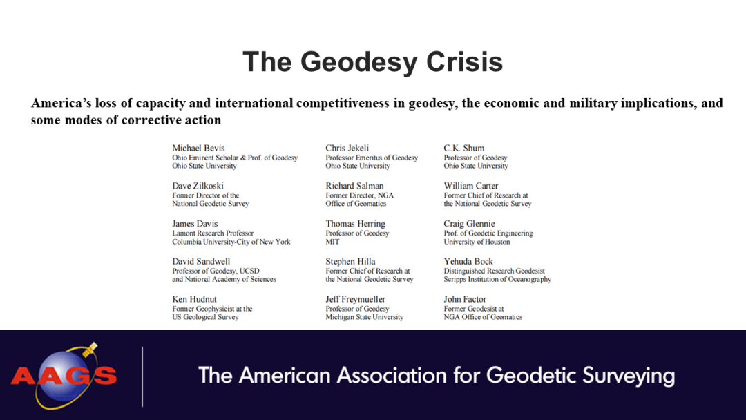
At the beginning of 2022, the report "Crisis in American Geodesy" was published on the official website of the American Association of Geodesy [1]. The report, co-authored by leading experts in the field of geodesy in the United States, points out that the United States is losing its international competitiveness in the field of geodesy and gives recommendations for correction. The following text and PPT were translated and written in first draft by Dr. Xiaodong Chen, PhD student, School of Geospatial Engineering and Science, Sun Yat-Sen University, and revised by Prof. Wei Feng. The contents of the report should be interpreted with a cautious and questioning attitude, and also serve as a cautionary tale for ourselves. Please refer to the original text for any inappropriate translations, and take no responsibility for the text. I would like to share this report with my colleagues in China.
Report Summary
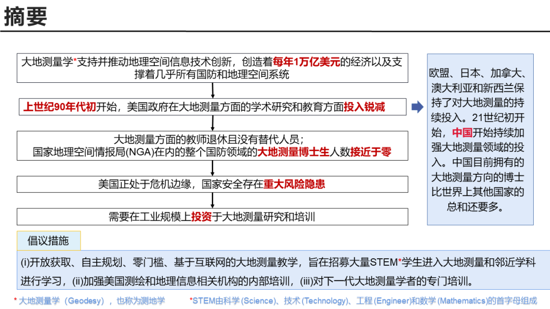
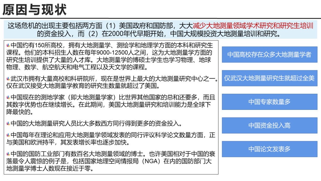
Geodesy is the foundation of geospatial science. It underpins and drives innovation in spatial information science and technology and generates approximately $1 trillion per year in economic value in geospatial technology. In the early 1990s, the U.S. government (particularly the Department of Defense) experienced a dramatic decline in its investment in geodetic research and education. In contrast, EU countries have continued to invest in the development of geodesy over the past few centuries, building a favorable academic climate. This is also the case in countries such as Japan, Canada, Australia and New Zealand. In addition, since the beginning of the 21st century, China has continued to invest in geodesy and now has more PhDs in geodesy than the rest of the world combined. During this time, U.S. geodetic strength has declined, with older geodetic experts gradually retiring but few new additions. China's defense industry, on the other hand, now has at least hundreds of PhDs in geodesy. In the most egregious example of U.S. decline relative to China, the number of geodesy PhDs in the defense sector, including the National Geospatial-Intelligence Agency (NGA), is now close to zero. The same is true for the U.S. defense industry. This threatens our national security and poses a significant risk to those sectors of the economy associated with geospatial information, geosciences, and space science.
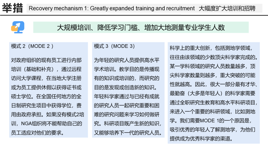
It is not too late to mend the situation. The United States needs to support geodetic research and related talent training on an industrial scale. We recommend three different training models to reverse the crisis and more diverse and robust support for funding geodetic research. Geodesy and related disciplines and basic research must be significantly increased and appropriately supplemented by funding for applied research. Such research should be conducted in academia, industry, and government/DoD laboratories. All U.S. government mapping and geographic information agencies and services should be involved in positioning and funding the frontier direction of geodesy and ensuring that all important R&D issues are supported and addressed. Among these, the following three complementary parallel education and training models should be considered: (i) open access, self-planned, zero-threshold, Internet-based geodesy instruction designed to recruit large numbers of STEM students into geodesy and adjacent disciplines; (ii) in-house training at U.S. mapping and geographic information-related agencies; and (iii) specialized training for the next generation of geodesy scholars. The third model in particular is essential, and it is critical to the deepening and advancement of geodetic science research.
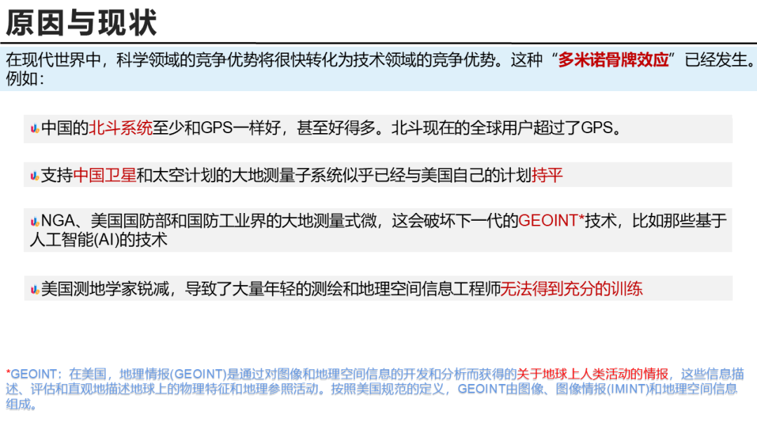
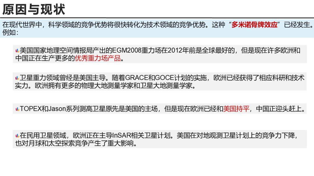
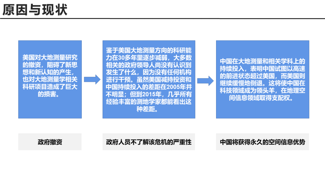
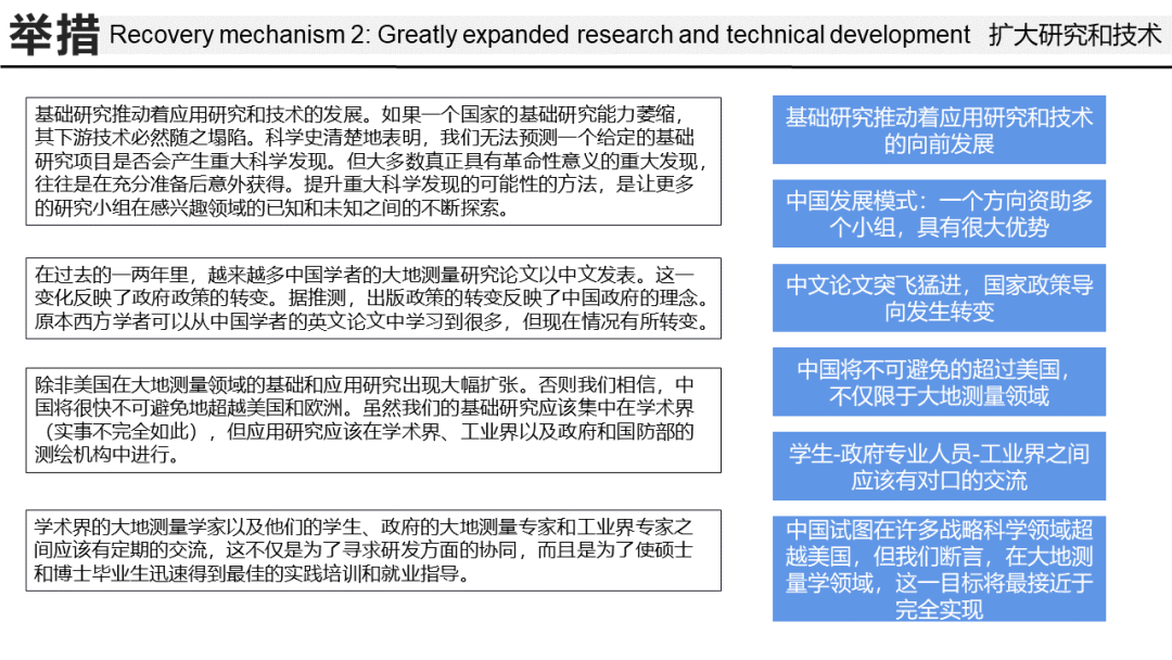
In geodesy and its downstream geographic information spatial technology base, a significant competitive advantage in science will soon translate into a significant competitive advantage in technology. This "domino effect" has already occurred, and the U.S. is on the verge of continued decline. With the continuous improvement of such technologies as Beidou in China and InSAR in Europe, the U.S. is already in a backward position. Given the gradual decline in U.S. geodetic research capabilities over more than 30 years, most relevant government leaders do not yet recognize what is happening because no agency has intervened. While the gap between the reduced U.S. investment and China's continued investment was not apparent in 2005; by 2015, the gap will be apparent to almost all experienced geodesists. This outcome would seriously threaten U.S. defense security and present a significant threat to the closely related economy of the U.S. geospatial revolution. The situation in academia is particularly urgent because if not addressed soon, the United States will lose the opportunity to take remedial measures to avoid long-term disadvantage.
[1]https://aagsmo.org/the-geodesy-crisis/
