
Review of Yixian Smart Mapping Forum | Jianxiong Ge: Ancient Chinese Cartography and Its Cultural Significance
Ancient Chinese cartography has a long history and a rich accumulation of cartographic theories and practices, and tracing its history is important for learning and understanding cartographic culture. For this reason, on October 26th, the Yat-Sen Intelligent mapping Forum invited Mr. Jianxiong Ge, Senior Professor of Fudan University and Visiting Professor of Sun Yat-Sen University, to give a lecture on "Ancient Chinese Cartography and its Cultural Significance". More than 60 teachers and students from the School of Geospatial Engineering and Science, the School of Artificial Intelligence, the School of Civil Engineering and the School of Software Engineering participated in this lecture. Our Dean Cheng Xiao and Secretary Lin Weiting presided over the forum.
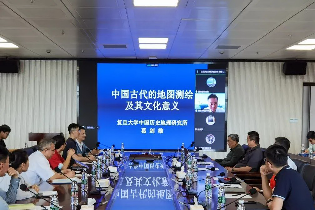
With rich historical materials, precious ancient maps and detailed cases, Prof. Ge narrated the history of ancient Chinese map mapping and analyzed the cultural significance of ancient Chinese map mapping. The lecture introduces the ancient mapping technology and the process of map formation in China, using the pictographs and the primitive map elements recorded in Zuo Zhuan as a guide, and sorting out and introducing them from ancient texts. The lecture focused on the "Map of Fangmatan" with the water system as the framework, the "Map of Mawangdui Han Tomb" with the unified legend identifying geographical elements, and Pei Xiu's "Yugong Geographical Map" and the six bodies of cartography. In retrospect, the mapping technology of each dynasty became increasingly mature, the content of maps became richer, and the functions and forms of maps became more complete, which laid an important foundation for the development of map mapping nowadays.
With his profound knowledge of history and geography, profound humanistic feelings and rigorous academic attitude, Professor Ge brought a wonderful cultural feast of ancient map mapping to the students and teachers, which won them a warm applause. Afterwards, Professor Ge interacted actively with the students and teachers on the spot. After listening to the lecture, students and teachers said that maps are the main expression of national maps, which visually reflect the scope of national sovereignty and reflect the political proposition of the country, and have serious political, strict scientific and strict statutory nature. Professor Ge's report is not only an academic report on history and culture, but also a higher requirement for our professionals in map research.
This lecture is the 10th lecture of Yat-Sen Intelligent mapping Forum, which is initiated by the School of Geospatial Engineering and Science of Sun Yat-Sen University and jointly organized by the Polar Research Center of Sun Yat-Sen University, the Guangdong Provincial Laboratory of Southern Ocean Science and Engineering (Zhuhai) and the Journal of Remote Sensing. By inviting domestic and foreign experts and scholars in the field of surveying and mapping science and technology to conduct regular frontier series of academic lectures, discussing the frontier of surveying and mapping technology and science, looking into the future development trend, exchanging new academic ideas and new methods, building a high-level, multi-disciplinary academic exchange platform, creating a relaxed academic exchange environment for teachers and students, promoting disciplinary crossover and integration, enlightening scientific and technological innovation ideas, and devoting to building The forum will become a brand with foresight and wide influence.
