
Recruitment | The geodesy and navigation technology team of Zhongshan University invites talents from home and abroad to join us
I. Introduction to the College
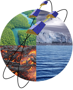
The School of Geospatial Engineering and Science of Sun Yat-Sen University was established in April 2019, located in the beautiful and livable city of Zhuhai. The School adheres to the "Four Orientations" and focuses on the frontier of "deep space, deep sea, deep earth and polar exploration" of the country, with the primary discipline of "Surveying and Mapping Science and Technology". At present, there are more than 60 full-time teachers and researchers, including academicians, national outstanding young people and national outstanding young people. The School focuses on four major research directions, namely, advanced remote sensing technology, geodesy and navigation technology, polar and marine remote sensing, and environmental remote sensing.
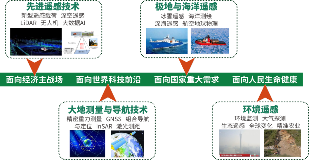
Four major research areas of the School
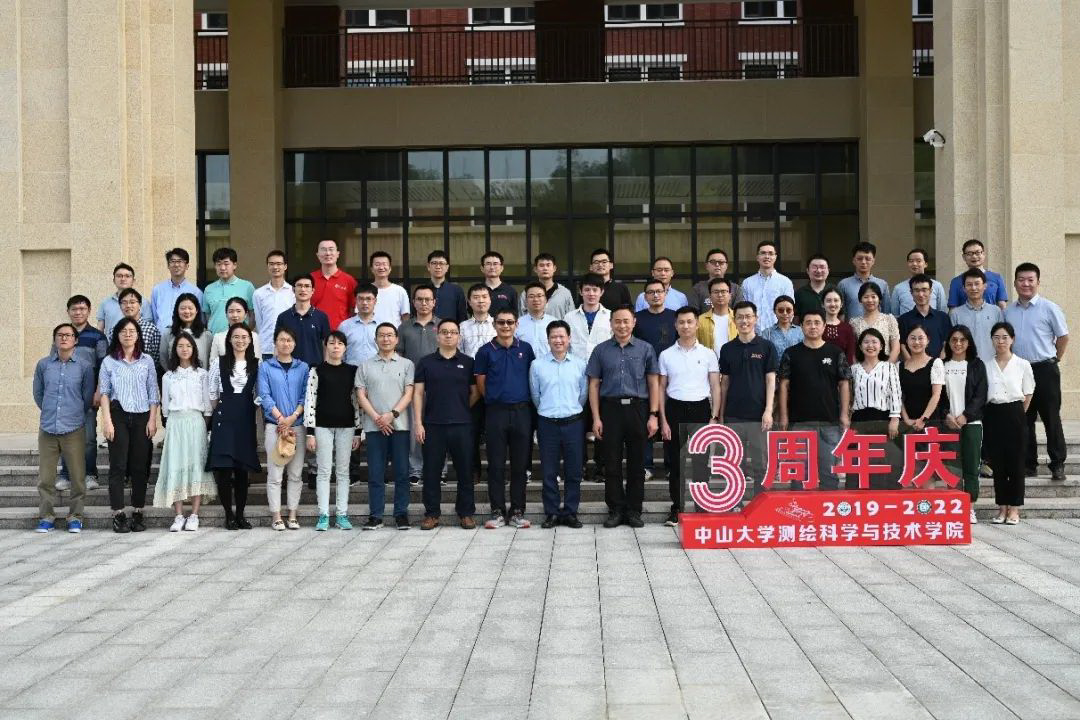
Group photo of faculty and staff on the third anniversary
II. Introduction of Geodesy and Navigation Technology Team
1、Research Direction
Satellite gravity measurement and scientific applications; air-space-space-sea multi-source gravity data fusion and high-precision gravity field modeling; radar image geodesy technology and surface deformation monitoring; satellite precision orbiting, positioning and combined navigation.
2、Team Members
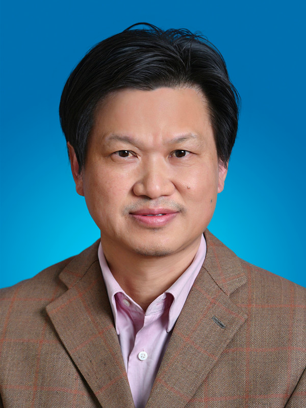
Chief Scientist: Prof. Min Zhong

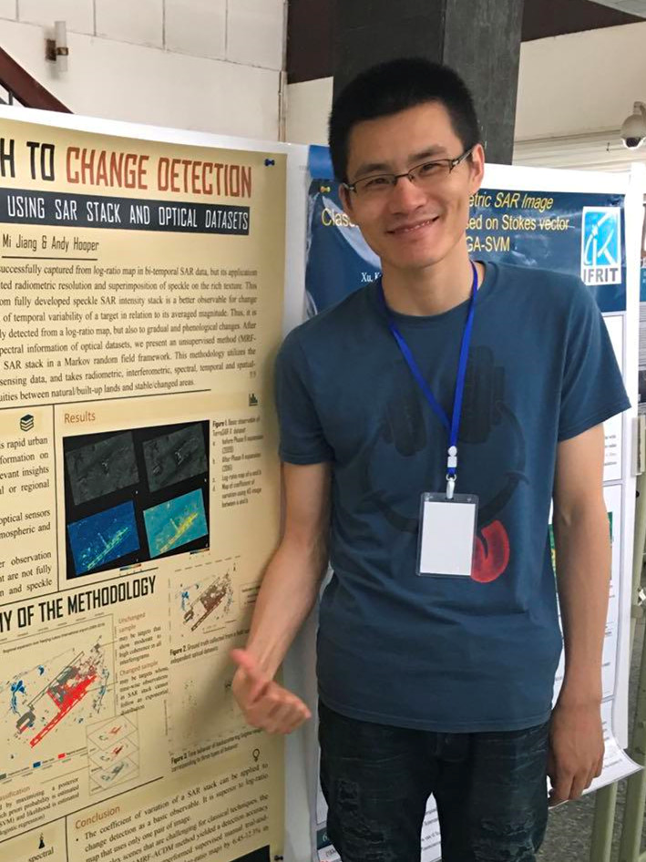

Prof. Wei Feng Associate Prof. Mi Jiang Associate Prof. Zhongshan Jiang


Assistant Prof. Xingyuan Yan Assistant Prof. Meng Yang Postdoctoral Fellow, Yingchun Shen
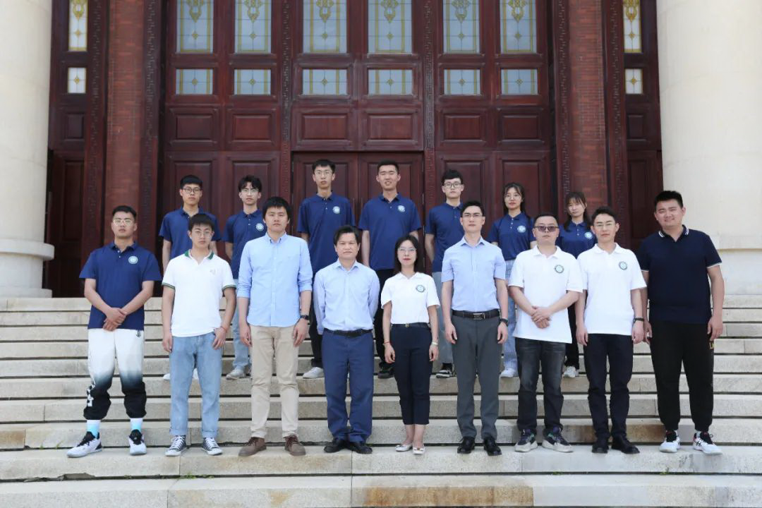
Group photo of team teachers and students
3、Introduction of research results
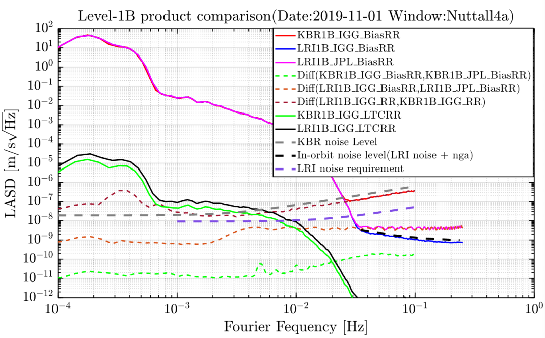
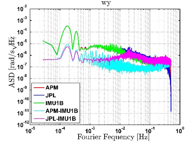
(1) The platform of gravity satellite raw data preprocessing system is established to serve the construction and development of China's independent gravity satellite. Based on this platform, the accuracy of GRACE Follow-On Level-1B products is comparable to that of the international published products, and the accuracy of laser interferometric range data preprocessing and star-sensitive data preprocessing is better than that of the international published products. The research results were successfully applied to the inter-satellite ranging data pre-processing of the first gravity satellite in China.
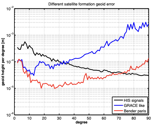
(2) Breakthrough in the core technology of satellite gravity field inversion, realize the independent development of high-precision time-varying gravity field products and software; host the international cooperation of "China-Europe next-generation gravity satellite", carry out the simulation of next-generation gravity satellite, and promote the construction and implementation of China's gravity satellite program.
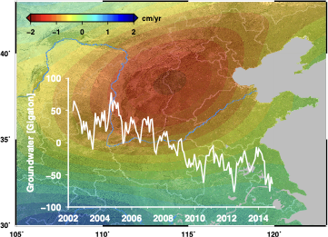
(3) In the field of satellite gravity application, we carried out global and regional monitoring of land water/groundwater changes based on satellite gravity, and for the first time quantitatively estimated the spatial and temporal distribution and long-term trend of groundwater storage changes in North China, deepening the understanding of deep groundwater changes in North China; the "gravity satellite-based large-scale drought remote sensing monitoring system" was successfully selected by the Ministry of Water Resources in the list of "2021 Mature and Applicable Water Resources Science and Technology Achievements Promotion".
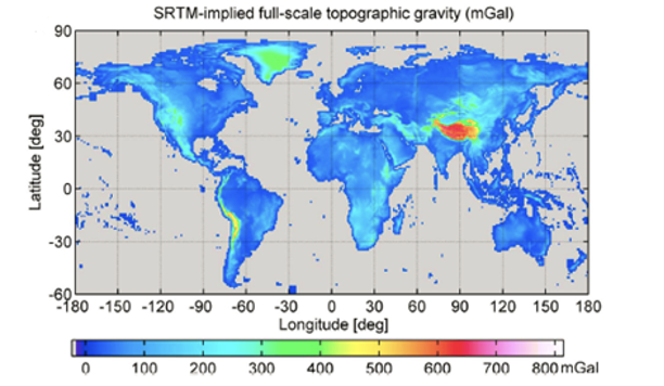
(4) Improve the theory and method of ultra-high-order gravity field modeling, build a high-precision calculation software platform, and release the first global topographic gravity field model, which can be widely used in scientific research and applications such as the determination of regional high-precision geoid, the unification of global elevation datum, and the inversion of the Earth's internal structure.
(5) Serving national strategic needs, participating in the construction of the "Precision Gravity Measurement" national major science and technology infrastructure, responsible for the construction of China's first aviation gravity gradient calibration field and gravity measurement evaluation unit.
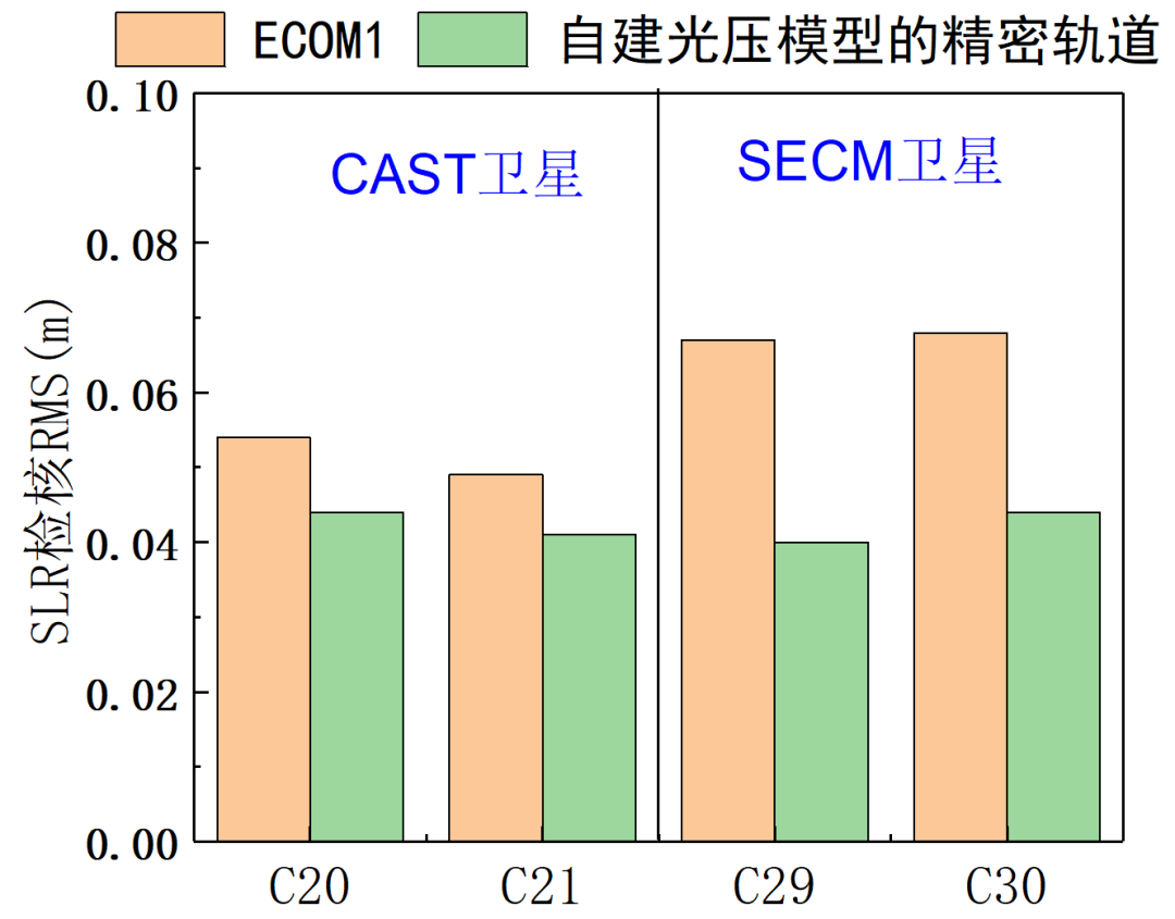
(6) Establishing the phase center correction model of Beidou-2 and Beidou-3 satellite antennas to improve the accuracy of Beidou orbiting and positioning; establishing the publicly available Beidou-3 MEO satellite a priori optical pressure model based on satellite metadata, resulting in a 36% improvement in orbiting accuracy.
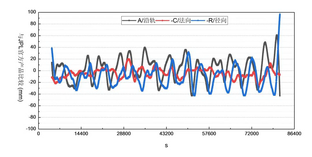
(7) Build high-precision GNSS data processing software to realize multi-system precision orbit, clock difference, troposphere, Earth rotation parameters and other precision service products solving. The high-precision orbit of GRACE satellite of 2cm can be achieved by using the self-decoded precision orbit and encrypted 30s clock difference.
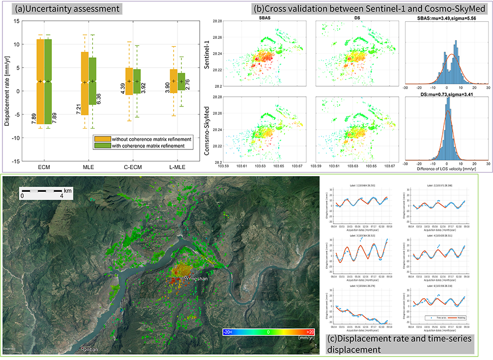
(8) Establishing the InSAR complex domain statistical inference theoretical system. As the basis of statistical inference, the likelihood estimators and confidence intervals for the selection of independent identically distributed samples are derived to ensure the assumption of sample smoothness and improve the computational efficiency of existing classical methods by nearly 200 times; under the complex circular Gaussian model, the interference coherence, the unbiased estimators of complex covariance matrix and the great likelihood estimators of deformation parameters are derived. Based on the aforementioned theoretical basis, the full-resolution distributed target time-series analysis technique is developed with coherence estimation as the main line, which achieves millimeter-level deformation monitoring accuracy of low coherence surfaces such as vegetation environments under the premise of reliability and improves the overall accuracy of existing mainstream InSAR time-series analysis techniques by 2%-40%.
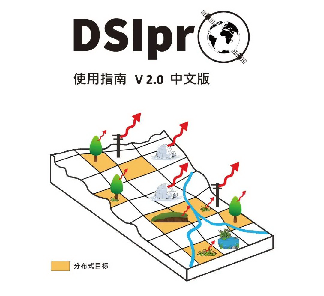
(9) To disclose the core algorithms of new InSAR-related theories and technologies to domestic and foreign colleagues, and independently release DSIpro v2.0 open source software. DSIpro v2.0 is a synthetic aperture radar interferometry (InSAR) time-series analysis open source software for low coherence surface deformation monitoring, such as vegetation environment, which can significantly improve the signal-to-noise ratio of interferometric signals and provide geoscientific researchers with High-quality data source. Up to now, the software has been downloaded 1257 times by 104 institutions worldwide, including 34 international institutions such as Purdue University, TUM, UCL, UNAVCO, and 70 domestic institutions such as Peking University, Chinese Academy of Sciences, and WOU. The software can be downloaded at http://mijiang.org.cn/index.php/zh/software-2/
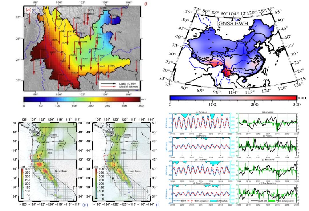
(10) Expand GNSS hydrology applications. Based on the load deformation theory, the inversion of land water storage in the air domain based on dense GNSS observation data and the inversion of land water storage in the spectral domain based on sparse GNSS data are realized for the distribution of GNSS stations with different spatial coverage. A study on GNSS monitoring of extreme drought events is carried out, and a new drought monitoring index: GNSS-DSI is proposed, which comprehensively confirms that GNSS information can be used for monitoring and assessment of extreme hydrological events.
(11) Expansion of GNSS seismic geodesy applications. Using GNSS technology as an observation tool, a lot of research work has been carried out on crustal deformation patterns, plate motion characteristics, fault coupling laws, stress transmission mechanisms, seismic breeding behavior and earthquake rupture patterns. Based on interseismic velocity data, we study crustal strain, block motion and fault occlusion degree; investigate fault sliding distribution and analyze Coulomb stress change based on isoseismic displacement data; quantify postseismic deformation mechanism and constrain lithospheric medium parameters based on postseismic deformation data.

III. Geodesy and navigation technology team talent recruitment
1、Recruiting discipline direction
Satellite gravity raw data processing and its scientific applications
Surface deformation monitoring (GNSS, InSAR)
Combined navigation and positioning
Air-space-sea integrated gravity observation and high-precision gravity field fusion
Multi-source remote sensing observation and analysis of surface mass migration
Planetary geodesy
Ocean mapping and marine seismic positioning
2、The "Hundred Talents Plan" introduced talents
(1) Subject leader
Engaged in research work with great innovation, development prospect and key common technology, and achieved landmark results with important innovation and significant impact. They have significant influence, academic status and academic level at home and abroad, and their age is not more than 45 years old.
(2) Young and middle-aged outstanding talents
With particularly excellent scientific research and technological innovation potential, research direction with important innovative prospects, professional achievements recognized at home and abroad, and scientific research achievements recognized at home and abroad, age in principle not more than 40 years old.
(3) Young academic backbone
With active and innovative thinking, strong innovative ability and outstanding development potential, achieving high level and innovative professional achievements, not more than 35 years old.
3、Full-time Researchers
(1) Distinguished Researchers
Those who have postdoctoral, lecturer or assistant professor work experience in universities and research institutions at home and abroad; in principle, they have achieved at least three representative results, and the number of those with particularly outstanding results can be reduced appropriately; those who have presided over or participated in projects at the provincial or ministerial level or above are given priority. Age should not exceed 38 years old.
(2) Specially Appointed Associate Researcher
The applicant has experienced rigorous academic training in universities and research institutions at home and abroad, and has greater academic potential; in principle, he/she has achieved no less than 2 representative results, and the number of those with particularly outstanding results can be reduced to 1; he/she should not be older than 38 years old.
(3) Postdoctoral
The postdoctoral candidates should be under 35 years of age, have obtained their doctoral degrees within 3 years, and have high academic level and strong scientific research ability.
4. Contact Information
College website: http://sges.sysu.edu.cn/
Contact Person: Ms. Li
Tel: +86-0756-3668466
Resume delivery email: sges@mail.sysu.edu.cn
