
A simulation on relativistic gravimetry by using optical fiber backbone network in China
Abstract: With the rapid development of time-frequency transfer technology and the continuous improvement of atomic clock measurement accuracy in recent years, relativistic gravimetry is gradually moving from theoretical research to practical application. Based on Chinese optical fiber backbone network, this paper comprehensively considers the accuracy level of optical atomic clocks from many institutions to carries out a relativistic gravimetry simulation experiment. At the same time, the effects of tide and multi-link observation in single-way time-frequency transfer (SWTFT) and two-way time-frequency transfer (TWTFT) is discussed. The experimental results show that based on the relativistic gravimetry method and the 40Ca+ optical clock from Innovation Academy for Precision Measurement Science and Technology (APM), Chinese Academy of Sciences (CAS) and Chinese optical fiber links, it is expected to achieve an accuracy of 8.1 mm for height determination spanning over a thousand kilometers. Moreover, this paper establishes an indirect adjustment function model of optical fiber network based on relativistic gravity measurement. Based on SWTFT, the overall accuracy of the height measurement of 11 stations is improved from 21.0 mm to 9 mm after the indirect adjustment applied to the optical fiber network. When the TWTFT is used, the overall height measurement accuracy is 11.5 mm before the indirect adjustment, which is about 40% higher than SWTFT. After the indirect adjustment through the optical fiber network, it was further improved to 8.9 mm, which is on the same level of accuracy based on SWTFT. Based on real optical clocks and fiber link stability indicators, our simulation research provides a reference for relativistic gravimetry experiments based on Chinese optical fiber backbone network in the near future, and also pave the way for establishing and maintaining mm-level height datum in China.
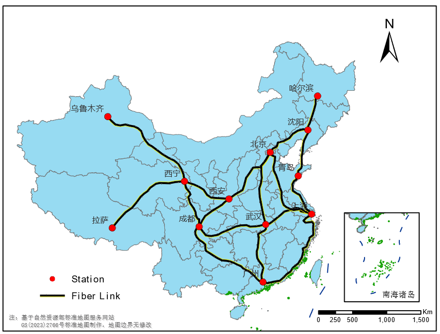
Fig.1 Distribution of fiber backbone networks in China
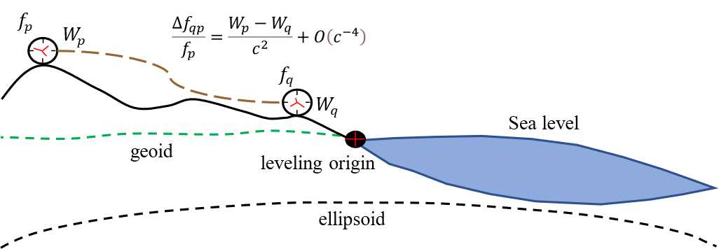
Fig.2 Scheme of relativistic geodesy
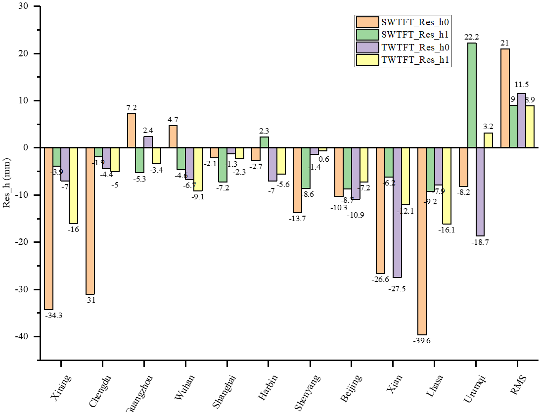
Fig.3 Height errors in different stations using indirect adjustment and based on SWTFT and TWTFT. SWTFT_Res_h0 and SWTFT_Res_h1 represent the residuals of the height values relative to the true values before and after adjustment when using SWTFT; TWTFT_Res_h0 and TWTFT_Res_h1 represent the residuals of the height values relative to the true values before and after adjustment when using TWTFT.
Citation:
