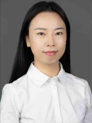
Meng Yang is an Assistant Professor in the School of Surveying and Mapping Science and Technology at Sun Yat-sen University.
He received his Ph.D. in Geodesy and Surveying Engineering from Technical University of Munich, Germany in 2020. His research interests include forward modeling and ultra-high-order gravity field modeling, multi-source data fusion theory and methods, planetary gravity field and inversion, and ocean gravity field research and application. He has published more than ten papers in GRL, SG, JG, GJI, SGG, RS and other journals in recent years.
Educational experience
2016.01 - 2020.04 Technical University of Munich, Germany, PhD degree
2011.09 - 2014.06 Institute of Surveying and Geophysics, Chinese Academy of Sciences, MSc
2007.09 - 2011.07 Chang'an University, B.S. degree
Work Experience
2020.06 - Present Assistant Professor, School of Surveying and Mapping Science and Technology, Sun Yat-sen University
Courses
Undergraduate: Fundamentals of Error Theory and Measurement Leveling
Graduate students: "Introduction to Gravity Measurement", "Theory and Application of Measurement Data Processing".
Scientific Research Projects
2022.01-2024.12, National Natural Science Foundation of China (NSFC), "Refinement of gravity field in Princess Elizabeth Land, Southeast Pole, integrating multi-source data and residual terrain modeling techniques", Chair.
2021.01-2023.12, Guangdong Provincial Natural Science Foundation, Key Technology Research on Refining the Gravity Field Model of Antarctic Region Based on Two-step Residual Terrain Model Technique, hosted;
2020.11-2022.06, National Key R&D Program Subproject, Gravity Field Fusion, subproject leader;
2022.01-2023.12, Open Fund Project of Key Laboratory of Geodesy and Geodynamics, Research on refining the gravity field model of Mars based on residual terrain model technique, chair;
2021.01-2025.12, National Key Research and Development Program Subproject, Impact and assessment of space gravitational and thermal environment on gravitational wave detection, principal participant;
2021.07-2023.06, Project of Guangdong Provincial Department of Natural Resources, R&D and industrialization of flux-conducting fusion chip and ocean information system, major participant.
Representative Publications:
1. Yang M., Hirt C., Wu B., Deng X.L., Tsoulis D., Feng W., Wang C.Q., Zhong M. (2022) Residual terrain modelling: the harmonic correction for geoid heights. Surv. Geophys., (online). (IF, 6.673)
2. Deng X.L., Shen W.B., Yang M., Kuhn M., Ran J.J. (2022) First Order Derivatives of Principal and Main Invariants of Magnetic Gradient Tensor of a Uniformly Magnetized Tesseroid and Spherical Shell. Surv. Geophys., (online). (IF, 6.673)
3. Deng X.L., Shen W.B., Yang M., Ran J.J. (2021) First-order derivatives of principal and main invariants of gravity gradient tensor of the tesseroid and spherical shell. J. Geod., 95(9). (IF, 4.781)
4. Yang M., Hirt C., Pail R. (2020) TGF: A New MATLAB-based Software for Terrain Gravity Field Calculation.Remote Sensing, 12(7). (IF, 4.848)
5. Yang M., Hirt C., Rexer M., Pail R., Yamazaki D. (2019) The tree canopy effect in gravity forward modelling.Geophys. J. Int., 219 (1). (IF, 2.528)
6. Hirt C., Bucha B., Yang M., Kuhn M. (2019) A numerical study of residual terrain modelling (RTM) techniques and the harmonic correction using ultra-high degree spectral gravity modelling. J. Geod., 93. (IF, 4.633)
7. Hirt C., Yang M., Kuhn M., Bucha B., Kurzmann A., Pail R. et al. (2019) SRTM2gravity: an ultra-high resolution global model of gravimetric terrain corrections. Geophys. Res. Lett., 46(9). (IF, 4.34)
8. Bucha B., Hirt C., Yang M., Kuhn M., Rexer M. (2019) Residual terrain modelling (RTM) in terms of the cap-modified spectral technique: RTM from a new perspective. J. Geod., 93. (IF, 4.633)
9. Yang M., Hirt C., Tenzer R., Pail R. (2018) Experiences with the use of mass-density maps in residual gravity forward modelling. Stud. Geophys. Geod., 62.
10. 胡明,张为民,杨萌,田蔚,钟敏 (2016) 抗差估计在自由落体式绝对重力仪中的应用. 大地测量与地球动力学,36(9). (CSCD)
11. 杨萌,钟敏,张为民 (2015) 绝对重力仪测量有效高度确定. 大地测量与地球动力学,35(4). (CSCD)
12. 杨萌,张为民,钟敏,田蔚 (2014) 小型快速绝对重力仪软件系统开发. 地球物理学进展,19(4). (CSCD)
Academic Reports
• Yang M., Hirt C., Roland Pail, The tree canopy effect in high-frequency gravity forward modelling. European Geosciences Union General Assembly, 2018. (Pico)
• Yang M., Hirt C., Roland Pail, TGF: A new MATLAB-based software for terrain gravity field calculation. 27thIUGG General Assembly, 2019. (Poster)
• Yang, M., Deng, X.-L., Zhong, M., Harmonic Correction for Residual Terrain Modelling (RTM) Technique in Physical Geodesy Applications, European Geosciences Union General Assembly, 2021. (Pico)
• Yang, M., Deng, X.-L., Feng, W., Wang, C.-Q., Zhong, M., Harmonic Correction for Residual Terrain Modelling (RTM) Technique in Physical Geodesy Applications, Scientific Assembly of the International Association of Geodesy, June 28 - July 2, 2021, Beijing, China. (Oral)
• 杨萌, Christian Hirt, 邓小乐,冯伟, 钟敏, 融合光谱法和空域法构建全球地形重力场模型, 第四届中国大地测量与地球物理学学术大会(CCGG),2021.07.16-19,青岛. (口头报告)
• 杨萌, 植被高对高频重力场建模的影响,中国地球科学联合学术年会,2020, 重庆. (口头报告)
Awards:
2021 Sun Yat-Sen University Young Teachers' Teaching Competition, Merit Award


